Thunderstorms and small hail hit southern QLD and northern NSW
Heavy showers and isolated thunderstorms have fired up across southern parts of Queensland northern...
Showers are set to develop across parts of northern NSW and SE QLD from late this evening until the end of the week.
A southerly change will move up the NSW coast during Tuesday and into southern QLD this evening. Isolated shower activity is expected to develop behind this change, with the potential for an isolated storm or two, most likely offshore.
During Wednesday and Thursday, a cold pool of air in the upper atmosphere will move into the region, generating weak instability. This will enhance shower activity, particularly for coastal locations, along with the potential for an isolated weak thunderstorm or two.
Shower activity will gradually ease during Friday and into Saturday, however a couple of millimeters will still be possible, particularly across exposed coastal locations in northern NSW and SE QLD.
Whilst drought breaking rain isn't expected for inland locations, 5-10mm will be possible, increasing to 10-25mm for coastal locations.
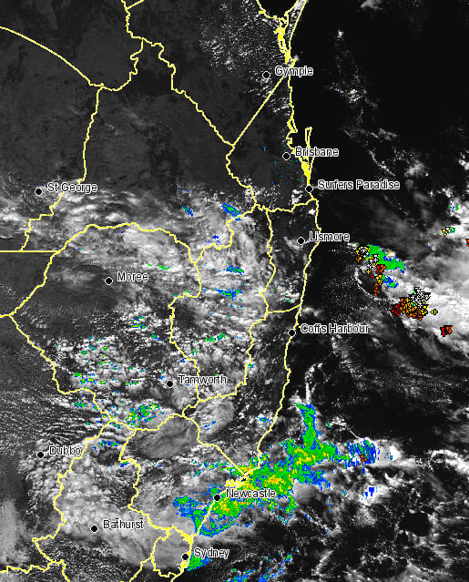
Image 1: EWN satellite image with radar and lightning overlay at 1pm
Heavy showers and isolated thunderstorms have fired up across southern parts of Queensland northern...
The arrival of winter is set to be greeted with a band of showers, patchy rain periods and isolated...
The weather radar is starting to come to life much similar to yesterday with isolated thunderstorms...