Heavy rain and severe thunderstorms spreading across southeast Australia
A dynamic weather pattern is unfolding across the southeast of Australia as a complex low pressure...
After a lean start to the storm season, things are going to heat up over the next 48 hours across central and western Victoria as a strong low pressure system and cold front sweep across southeastern Australia.
During Tuesday afternoon, a few thunderstorms are expected to develop across far western parts of the state, with the threat of an isolated severe storm or two. High based thunderstorms are expected, with the potential for damaging winds in the form of microbursts.
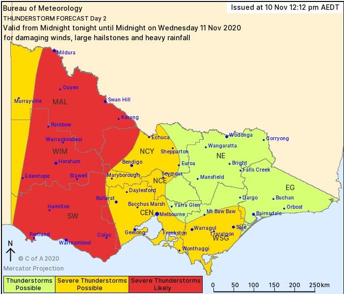
On Wednesday, cloud and showery conditions are expected during the morning hours before substantial storm activity develops along the trailing cold front.
Numerous thunderstorms are expected to develop late Wednesday afternoon with strong wind shear favouring a few organised storms capable of producing damaging to locally destructive winds, large hail and the potential for heavy rain leading to flash flooding across western parts of Victoria.
This system will slowly move east into Thursday, with scattered showers expected to continue across central and southern parts of the state, as westerly winds wrap around the backside of the low pressure system over Tasmania.
Image 1: Bureau of Meteorology day 1 thunderstorm outlook.
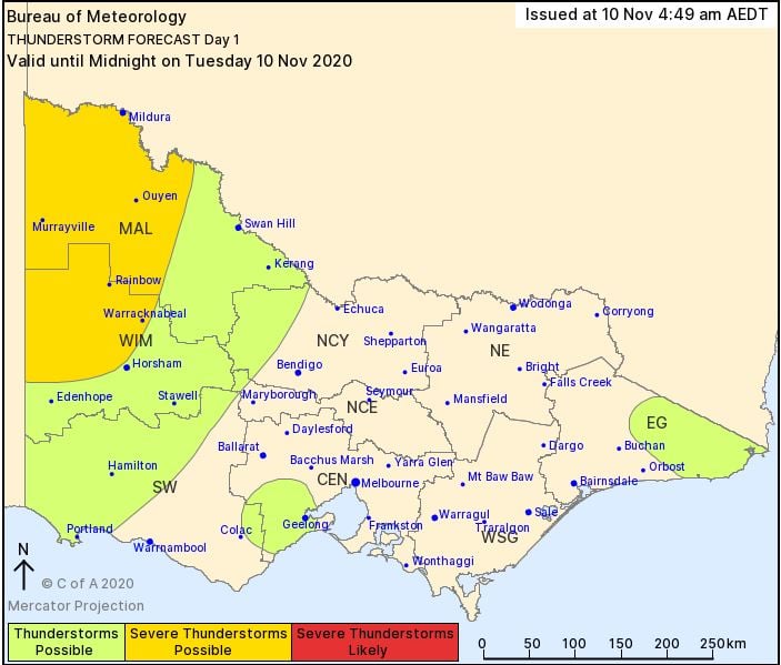
Image 2: Bureau of Meteorology day 2 thunderstorm outlook.
A dynamic weather pattern is unfolding across the southeast of Australia as a complex low pressure...
Mostly fine conditions are likely across large portions of the country this week.
Spring is set to start off quite warm across Australia with September likely to be a warm one...