Heavy rain to drench central-west and northwest WA
Heavy rain is about to soak parts of Western Australia's Central-west, Gascoyne and Pilbara...
A surface trough draped over the West Coast of Western Australia will trigger scattered showers and thunderstorms this afternoon and evening.
To the east of this trough, scattered storm activity is expected, with unstable conditions and sufficient wind shear to support at least a few organised thunderstorms that will be capable of producing damaging winds, large hail and heavy rain.
Areas between Perth - Geraldton - Meekatharra - Kalgoorlie are at the highest risk of seeing severe storms this afternoon and evening, before contracting slightly further south-west tomorrow.
Storm activity will continue across south-western WA for the next several days, with the potential for further severe thunderstorm activity to develop, particularly during Tuesday. Some of this storm activity may directly affect the Perth CBD over the next few days.
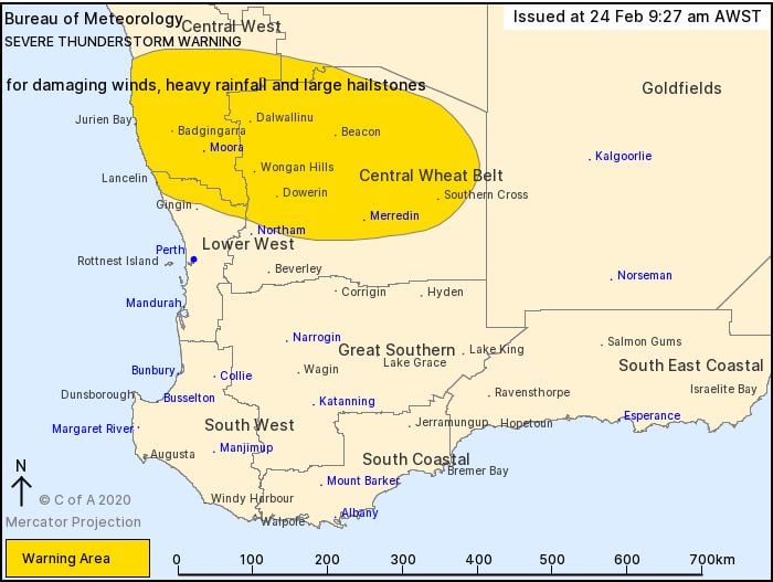
The Bureau of Meteorology has just issued a severe thunderstorm warning for damaging winds, heavy rainfall and large hailstones.
Image 1: EWN satellite and lightning tracker valid 9:50am 24/02/2020
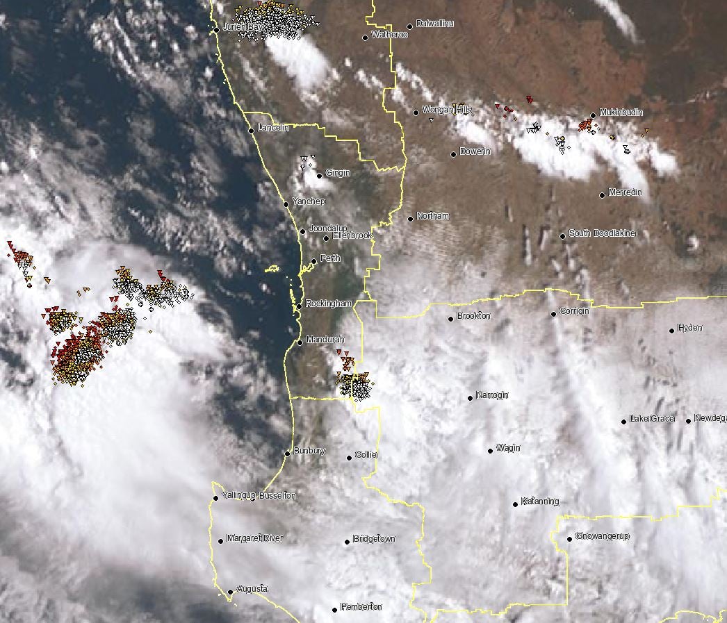
Image 2: Bureau of Meteorology severe thunderstorm warning map
Heavy rain is about to soak parts of Western Australia's Central-west, Gascoyne and Pilbara...
Thunderstorm activity is set to return to inland parts of the South West Land Division of Western...
The South West district and South Coastal district of Western Australia are expected to be impacted...