Balmy conditions ahead of possible storms and cool change in northeast NSW/southeast QLD
Northeast New South Wales and southeast Queensland are being treated to stunning winter warmth...
A high pressure system in the Tasman Sea will direct onshore south-easterly winds across NSW and QLD this week.
South-easterly winds will increase moisture across the region, and in combination with an upper trough will generate scattered to widespread showers from Monday onwards.
Isolated thunderstorm activity will be possible, particularly during Tuesday when an increase in instability will be present throughout the region, albeit rather weak.
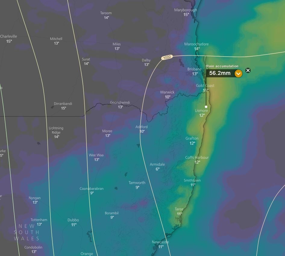
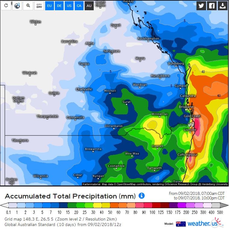
Falls of 15-30mm are expected across coastal and adjacent inland areas, with isolated heavier falls exceeding 50mm possible from Monday onwards. While shower activity will be a welcome relief from the recent dry winter, most of the rainfall is likely to remain across coastal locations.
As the weekend approaches, a low pressure trough will sweep across inland regions where scattered thunderstorm activity may develop. At this early stage, the potential will exist for a couple storms to become severe.
Image 1, EC accumulated rainfall totals next 5 days windy.com. Image 2, GFS total rainfall accumulation next 5 days weather.us.
Northeast New South Wales and southeast Queensland are being treated to stunning winter warmth...
Widespread storm activity is likely to develop for parts of Victoria, New south Wales, inland...
The coldest nights of winter so far are gripping many parts of Queensland as widespread frost...