Mostly fine conditions expected country wide
Mostly fine conditions are likely across large portions of the country this week.
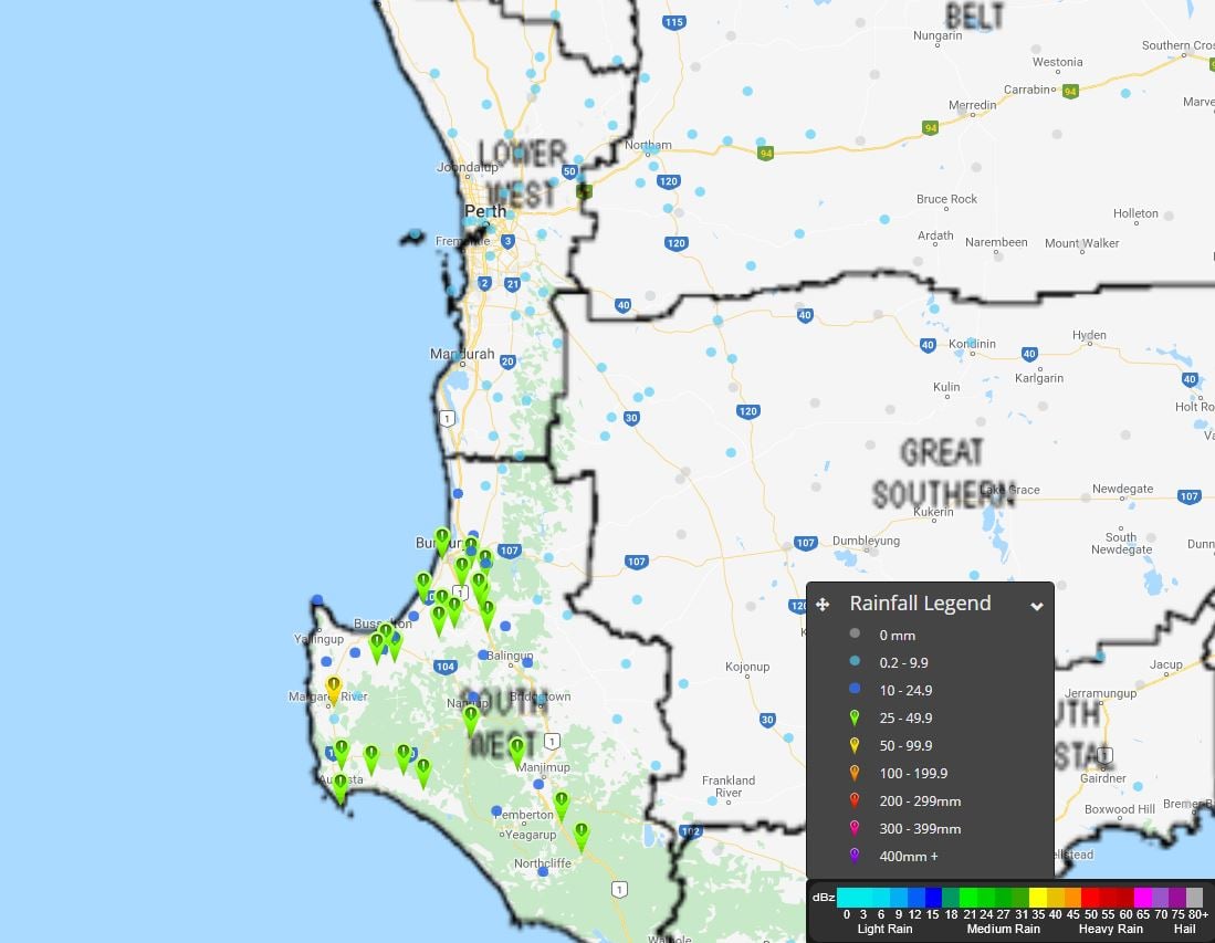
Moderate falls are beginning to develop across parts of WA this morning as a strong cold front moves across the region.
At present, a large rain band with widespread falls of 10-20mm have been recorded, with heavier falls in the 30-70mm range across the South West. While rainfall have generally been light across the Perth region this morning, more substantial activity is expected throughout Monday.
Heaviest falls to 9am this morning are: Margaret River 67mm, Beedelup 52mm and Milyeannup 45mm.
A gust of 106km/h was recorded at Cape Leeuwin at 3:22am Monday morning.
A SEVERE weather warning remains in effect for damaging winds and heavy rainfall that may lead to flash flooding over the next 24 hours.
EWN rainfall map to 9am AWST
Mostly fine conditions are likely across large portions of the country this week.
A moist and unstable airmass across SE QLD has resulted in heavy showers and storms across the Gold...
Near-record breaking temperatures are expected across a large portion of the country over the next...