Severe weather strikes South Australia
A multi-day severe weather event kicked off in South Australia on Tuesday, with damaging to...
Parts of central and eastern NSW are expected to see a few severe thunderstorms fire up on Monday afternoon, as spring-like conditions develop ahead of cold blast, snow and East Coast Low.
A strong upper trough and cold front is moving across the state, with weak to moderate instability combining with strong wind shear to generate widespread showers, rain periods and isolated storms. A few of these storms are expected to become severe today with damaging winds, heavy rainfall and localised large hail (2-4cm), particularly east of a line from Bourke - Cobar - Cootamundra.
This strong upper trough will help induce a low off the southern/central NSW coast overnight Monday into Tuesday morning, before rapidly intensifying during Tuesday.
Damaging winds gusts are expected to develop for exposed coastal locations and elevated terrain from the Hunter region to the South Coast during Tuesday, with gusts of up to and exceeding 90km/h. Late Tuesday evening, locally destructive winds exceeding 120km/h will be possible, particularly if any thunderstorms develop. An isolated tornado will also be possible for this region.
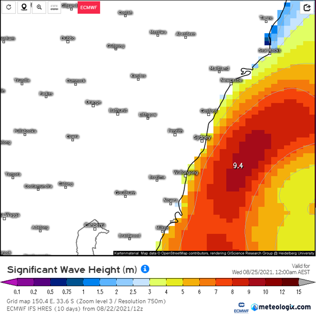
Large and powerful waves will develop across the NSW coast, with 3-5m waves likely across the southern and central coast, with waves of up to and exceeding 7m likely offshore as this ECL rapidly strengthens.
Areas of heavy rain will also develop, with widespread falls of 50-70mm, with heavy falls of up to and exceeding 100mm possible. This may lead to flash flooding for coastal regions and low-lying terrain.
A severe weather warning is expected to be issued during Monday for damaging winds, heavy rainfall and hazardous surf conditions.
Snow will develop across alpine regions of Victoria and NSW overnight into Tuesday, with snowfall pushing further north into the Oberon - Lithgow - Bathurst region as a very cold airmass wraps around the western periphery of this developing ECL. Snow accumulation of 5-15cm may develop, particularly for any higher terrain. A dusting of snow is also possible for higher terrain in the Northern Tableland during Tuesday.
Image 1: Potential wind gusts for 3 different models at 11pm Tuesday night. EC, ICON and GFS. Image via Windy.com
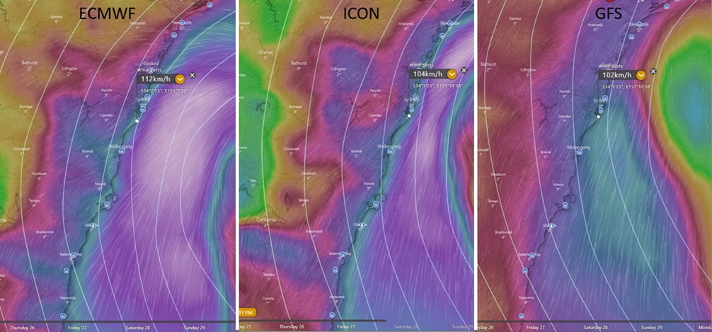 Image 2: Accumulated precipitation next 36-84hours. Images via WeatherWatch Metcentre.
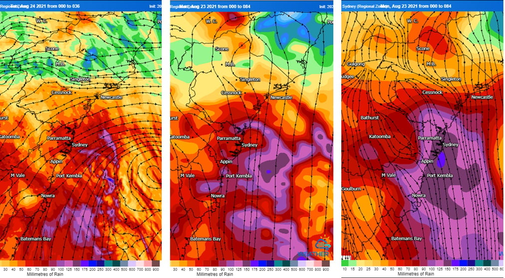 Image 3: Significant wave heights off the NSW coast overnight Tuesday into Wednesday. Image via Weather.US
A multi-day severe weather event kicked off in South Australia on Tuesday, with damaging to...
Widespread thunderstorms swept across eastern Victoria, New South Wales and Queensland over the...
The afternoon of Thursday 28 September will see thunderstorm activity return to South East...