Cold front sweeping across southern Australia
July will kick off with a cold blast across Australia's southeast, with strong winds, showers,...
A thick cloudband is stretching from Australia's northwest to southeast, bringing with it widespread rainfall across large parts of the country and the heaviest winter falls in years to some areas.
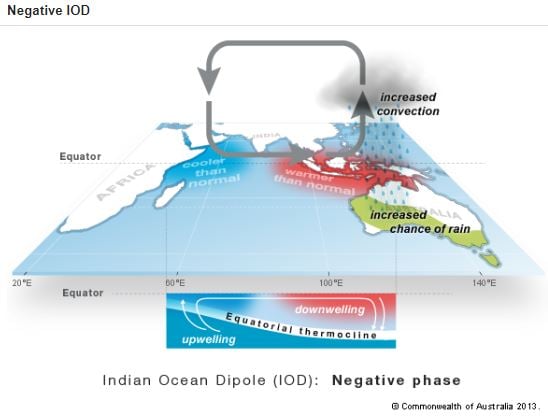
The cloudband, which is known as a 'northwest' cloudband, has developed in response to warm and humid air over the eastern Indian Ocean, and is being pushed rapidly into the southeast of the country due to a strong northwesterly subtropical jet. Warmer than average sea surface temperatures over the eastern Indian Ocean are enhancing the amount of moisture available, as we begin to transition into a negative phase of the Indian Ocean Dipole (when warmer water lies in the eastern Indian Ocean and cooler water lies in the west, enhancing rainfall over the nation). The last significant negative Indian Ocean event was in 2016, when Australia had its second wettest winter on record.
Image 1: Satellite imagery showing thick cloud stretching from northwest to southeast Australia
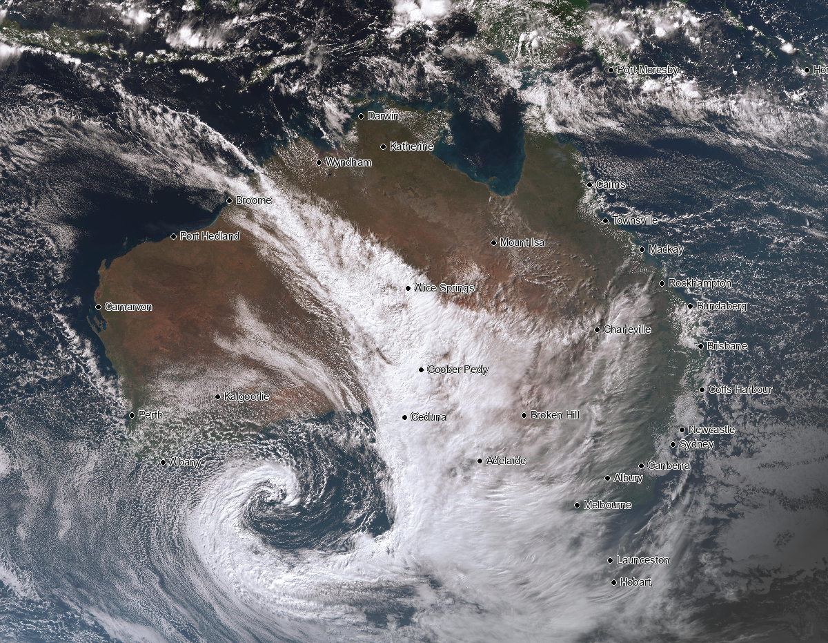 Image 2: A strong subtropical jetstream is directing the cloudband from the northwest of the country to the southeast (Source: BSCH Stormcast)
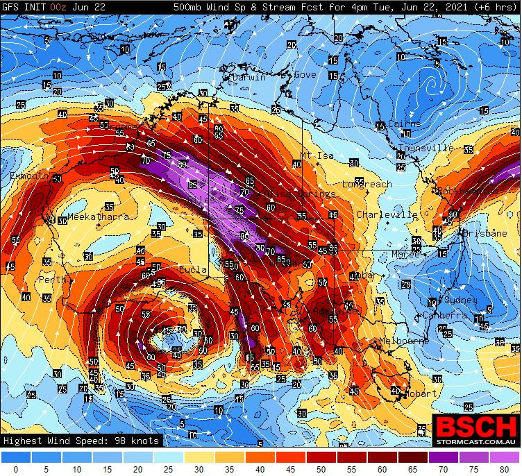
Image 3: A negative Indian Ocean Dipole and how it affects Australia (Source: Bureau of Meteorology)
Whilst a separate system caused heavy rainfall and flooding over western Australia's southwest the last few days, heavy rainfall also drenched parts of northwest Australia with some places seeing their best winter rain in years in what is normally their dry season. Marble Bar recorded 34mm in the 24 hours to 9am today, its heaviest winter rain since 2014 (and for June since 2013), whilst Mandora received 48mm, its heaviest winter rain since June 2013.
As this cloudband makes its way east across the nation, further good falls are likely within the next 72 hours, although the best rain will likely to be patchy with some places likely to receive little if any rain at all. Some of the better falls are expected over parts of coastal SA (20-40mm), northern TAS (15-30mm), VIC (5-30mm and up to 100mm in the northeast), southern and central NSW (20-70mm), northern inland NSW and southern QLD (10-40mm) and the southern NT (5-20mm). This may lead to flooding in some catchments that receive heavier falls, mainly northeast VIC and southern NSW.
Later this week, this system will finally push across southern and central QLD where falls of 10-30mm are likely, before moving out to sea during the weekend.
Image 4: Accumulated precipitation across the next 72 hours (Source: Weatherwatch Metcentre)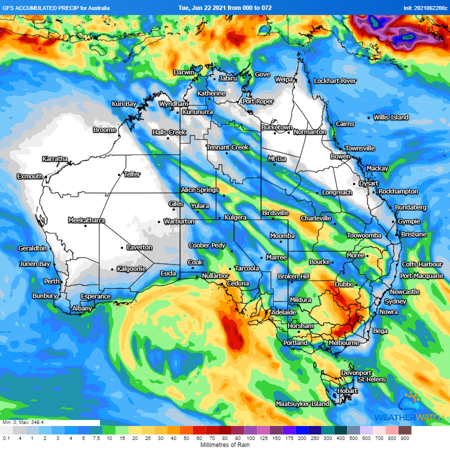
July will kick off with a cold blast across Australia's southeast, with strong winds, showers,...
A large upper and surface low is expected to start taking shape in the Great Australian Bight...
Parts of south-eastern Australia are set for a wet, stormy and cold start to April.