After an extremely dry winter, and horrific start to the fire season, some much needed and welcome rainfall is finally on its way for eastern QLD and NSW.
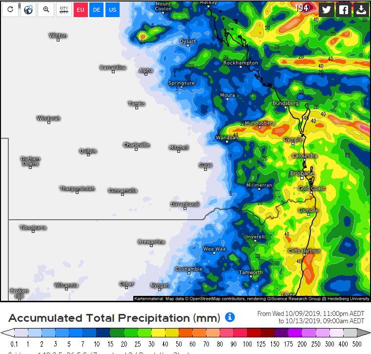
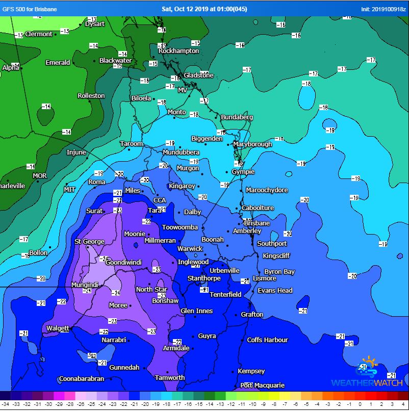
A broad upper trough will combine with moisture-laden east to northeasterly winds to generated scattered showers, rain periods and isolated thunderstorms during Friday, peaking during Saturday morning before clearing Sunday morning.
Falls of 20-40mm are expected, with isolated heavier falls of 50-100m possible, particularly with thunderstorm activity. This will be a welcome relief for fire-ravaged regions, with the potential for a couple of ongoing fires to be extinguished from this event.
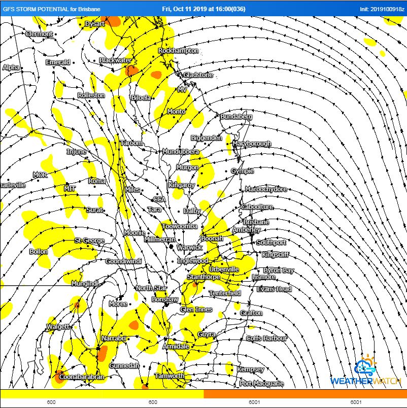
Wind shear profiles will be favourable for severe thunderstorms across central and southern inland QLD on Friday afternoon, however, heavy cloud cover may mitigate the severe potential across this region. Should strong heating occur, severe storm potential will increase with moderate to large hail and damaging winds possible.
Late into the weekend, a low pressure system may develop well off the QLD coast and move in a south-easterly direction, generating south-easterly winds with showers for coastal QLD and NSW. Further showers and storms may redevelop around mid-week, providing the perfect follow up rainfall.
Image 1: EC accumulation precipitation, Friday 9am to Sunday 9am. Weather.US
 Image 2: GFS storm potential for Friday afternoon. WeatherWatch MetCentre
 Image 3: 500mb temperatures showcasing very cold air aloft moving across NE NSW and southern QLD. WeatherWatch MetCentre
