Strong cold front to bring low-level snow to New Zealand
A strong cold front will sweep across New Zealand from this evening, bringing bitterly cold...
A late-season cold snap is developing across southern Australia, producing showers, thunderstorms, hail and snow from Wednesday until the weekend for Victoria, NSW, Tasmania and southeastern South Australia.
During Wednesday, a low pressure system south of Tasmania will continue to move into the Tasman Sea, directing cold west to southwesterly winds across parts of Victoria, southern NSW and Tasmania. This system is producing scattered showers, isolated thunderstorms with small hail and the potential for snow to fall above 900m across parts of Victoria and Tasmania late this evening.
Image 1: GFS accumulated precipitation, instability and upper level cold pool. Images via WeatherWatch Metcentre.
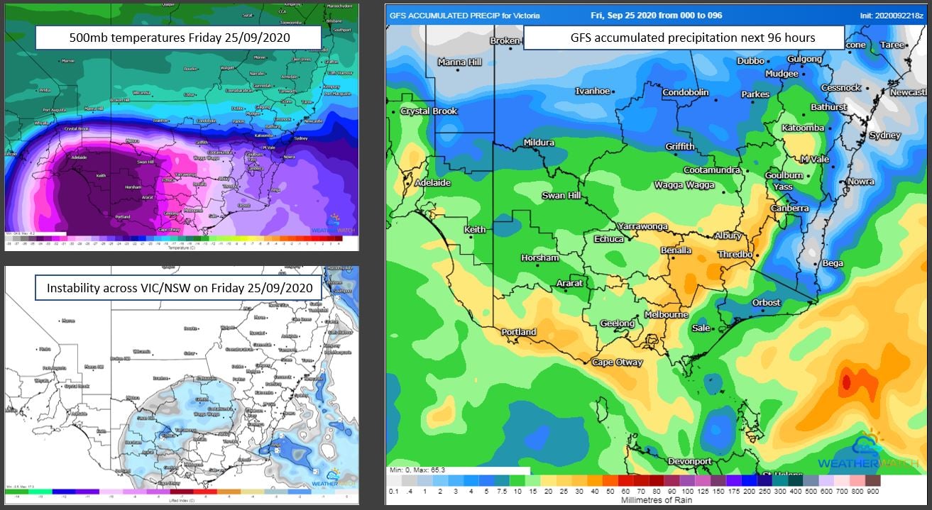
From Thursday into Friday, the low in the Tasman Sea will rapidly shift east towards New Zealand, with a secondary low and associated cold front shifting from southwest of Tasmania in a northeast direction, traversing southeastern Australia. This low, in combination with a high south of Western Australia, will drive a bitterly cold southwesterly flow across southeastern Australia. An associated upper cold pool of air will move into western Victoria, increasing instability across the region, with heavy showers, small hail, scattered thunderstorms and snow falling above the 800m level.
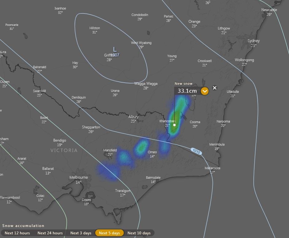
Alpine regions of Victoria and NSW are expected to see 20-30cm of snow over the next 5 days, with snow fall extending north into the Central Tablelands of NSW into the weekend, with the potential for sleet or a light dusting of snow across parts of the Flinders Ranges in SA
Image 2: EC forecast snow next 5 days. Image via windy.com
Widespread falls of 10-20mm are expected for SA, VIC, western TAS and southern NSW, with isolated heavier falls to 40mm possible for some locations, particularly with thunderstorms over the next 72 hours.
This bitterly cold airmass will keep maximum temperatures well below the September average for many locations, with Melbourne heading for a top of 12C Friday and 13C Saturday (September average of 17.3C), Adelaide 13C Friday and 15 Saturday (September average of 18.4), Hobart 13C across the weekend (September average of 15.1).
Image 5: EC rain and thunderstorms for Monday afternoon 21/09/2020. Image via Windy.com
Further storm activity will continue overnight Monday and into Tuesday morning whilst shifting northeast ? however severe storm activity is considered minimal across northeastern NSW and southern QLD at this time.
A strong cold front will sweep across New Zealand from this evening, bringing bitterly cold...
Winter is set to briefly depart from Queensland over the next few days, as a low pressure trough...
Another strong cold front is set to bring a fresh burst of showers, alpine snow and strong winds...