Winter deluge on the way for central QLD
A rare dry season rainfall event is set to unfold across parts of the Central QLD coast over the...
The next several days in southern Queensland is certainly going to be a period of two contrasting halves with northwesterly winds on Friday as well as heat and increased fire dangers in the southeast before colder southwesterly winds spread right across southern parts of the state with a front and trough.
Friday's maximum temperatures are forecast to climb up into the low 30s in inland parts of the Southeast as well as some parts of the Darling Downs especially in the north, and the Burnett districts but seabreezes close to the coastline are expected to keep temperatures down to the mid to high 20's along the coastal strip. Increasingly gusty winds in the southeast combined with the heat and dry conditions will also increase fire dangers on Friday. A fire weather warning is currently in place for severe fire danger on the Darling Downs and Maranoa and Warrego on Friday.
The stronger winds are expected to peak in the far southern interior of the state on Friday afternoon with occasional gusts up to 70 to 90 km/h and around 50 to 70 km/h for elevated terrain about the Granite Belt on Saturday. These winds may also help kick up some dust over the interior.
These gusty winds should persist on Saturday but will have turned cooler southwesterlies behind the front and trough. This will lower maximum temperatures to the low 20s across much of inland southern Queensland, the high teens on the Granite Belt and the mid 20s in the far southeast.
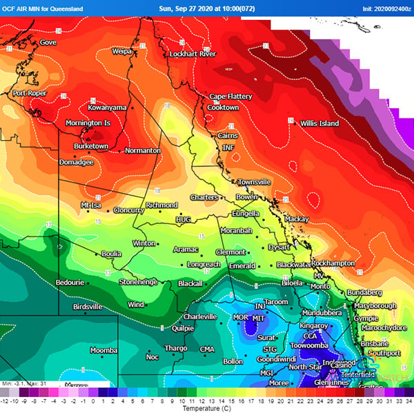
Sunday should feature similar maximum temperatures but the morning will be particularly cold with minimum temperatures down into the single digits across much of inland southern Queensland and even close to zero on the Granite Belt. This will cause frosts to become possible in far southern inland parts of the state.
Image 1: Wind gusts for 4pm Friday (Source: Windy.com)
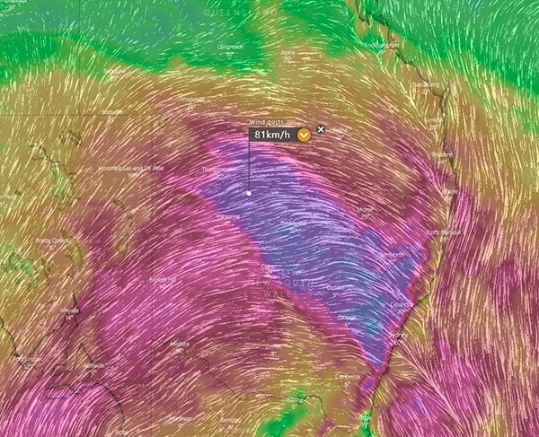 Image 2: OCF minimum temperatures for Sunday morning (Source: Weatherwatch Metcentre).
A rare dry season rainfall event is set to unfold across parts of the Central QLD coast over the...
Heavy rainfall has lead to flash flooding across parts of Mackay overnight.
A ridge over QLD will generate northwesterly winds ahead of an approaching cold front and...