Late season cold snap for southeastern Australia
A late-season cold snap is developing across southern Australia, producing showers, thunderstorms,...
A cold front will sweep across Western Australia on Thursday resulting in a cut-off low developing in the Bight late Friday and into Saturday.
Expect increasing rain to develop as moisture streams down from the Northern Territory thanks to the remnants of Tropical Cyclone Ann.
Whilst no significant falls are anticipated at this stage, totals of 10-25mm are possible, peaking during Saturday. Isolated heavier falls may develop with storm activity, along with a damaging wind threat.
Rainfall from this system will be extremely welcome after a dry start to the year, backing up falls from a similar system in late April/early May.
Image 1: GFS precipitation from Pivotal Weather.
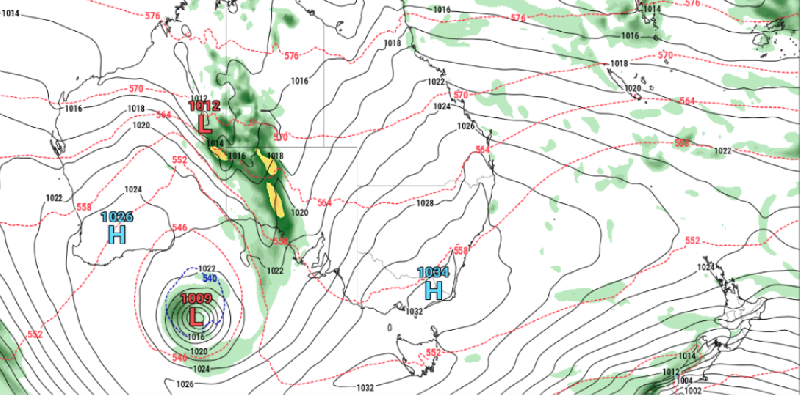
A late-season cold snap is developing across southern Australia, producing showers, thunderstorms,...
A strong cold front is beginning to move across southeastern Australia, causing strong northerly...
A strong cold front is dragging a hot airmass and strong winds once again over southeastern...