Heavy rain drenches western Tasmania amidst wet and windy week
A barrage of cold fronts has been producing some cold, wet and windy weather over Tasmania over the...
A barrage of cold fronts are bringing heavy rain, damaging winds and thunderstorms to southwestern parts of western Australia, with no let up in sight until the weekend.
The first of these fronts swept through on Sunday and into Monday morning, bringing a burst of wind, rain and in some places thunderstorms as well. Wind gusts reached up to 120km/h at Cape Leeuwin, 96km/h at Busselton, 93km/h at Walpole and 89km/h at Rottnest Island, whilst many parts of the Lower West district saw falls of 20-40mm, with 44.6mm falling at Perth city. This was the heaviest July fall in the city since 2001 (and for winter since June 2019), with reports of flooding in some parts of the city.
Showers are continuing over the southwest today, with squally showers and thunderstorms possible until later this afternoon. Another cold front will lash the region tomorrow, reaching the far southwest from the late morning and spreading throughout during the afternoon, with wind gusts of up to 100km/h, showers and isolated thunderstorms (which bring the risk of localised gusts up to 120km/h). Widespread falls of 15-30mm are likely, with some places seeing up to 50mm. Showers will persist on Wednesday in the wake of the front in response to a sharp upper trough, with brief squally thunderstorms and small hail also possible.
Conditions will ease on Thursday, before another front crosses on Friday, although the heaviest falls (up to 20mm) will be confined to the far southwest, with only light totals (1-10mm) spreading up through the Lower West and Central West. Drier conditions will return over the weekend, before current indications suggest another strong cold front arrives on Monday next week.
Image 1: Accumulated precipitation over the next 5 days from the GFS Model (Source: Weatherwatch Metcentre)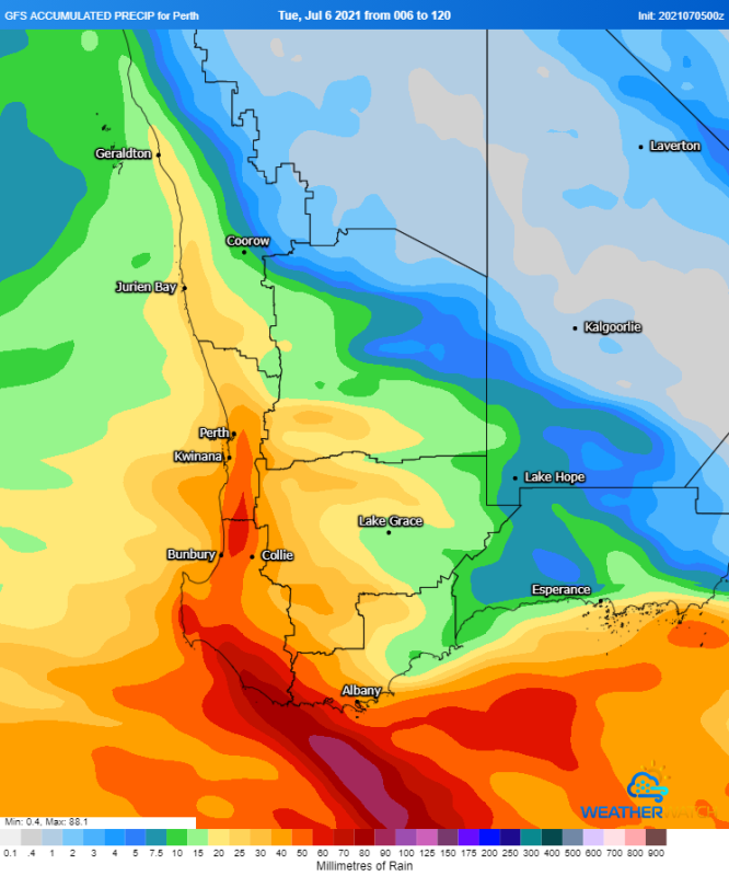
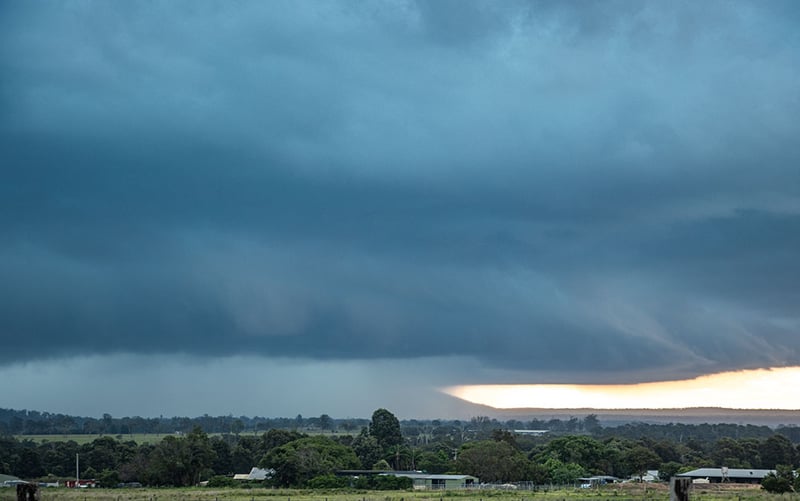
Image 2: ECMWF Shower and storm output for 5pm local time (7pm EST) on Tuesday 6th July, 2021
A barrage of cold fronts has been producing some cold, wet and windy weather over Tasmania over the...
Thunderstorm activity is set to return to inland parts of the South West Land Division of Western...
New South Wales is bathing in unseasonably warm mid-winter weather, with some areas experiencing...