Spectacular two-week fire animation loop
During November, catastrophic to severe fire dangers have been a daily occurrence across northern...
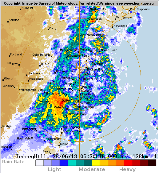
A cold front pushed through central parts of NSW today, causing temperatures to plummet as well as bringing gusty winds and thunderstorms to some areas.
The day began balmy for some, with Sydney and Cessnock reaching a top of 20 degrees, and Williamtown 21 degrees, three degrees above average for this time of the year.
However as the change moved through temperatures plummeted as showers and thunderstorms pushed through, accompanied by gusty winds on their arrival.
In Sydney the mercury was 18 degrees at 3pm, but as the change hit the temperature dropped by more than six degrees, falling to just below 12 degrees at 3:30pm. However, the temperature felt more like 4-5 degrees due to the associated winds.
In the Blue Mountains, the mercury only struggled to reach a maximum of 8 degrees due to cloudier skies earlier in the day, however as the change swept through it dropped to 4-5 degrees with the apparent temperature falling below freezing.
Tomorrow, mostly sunny skies are expected with temperatures returning close to average.
Sydney radar at 4:30pm EST, showing a band of rain and thunderstorms across the region
During November, catastrophic to severe fire dangers have been a daily occurrence across northern...
It's not too often that we get to post about such a decent stretch of the Queensland coast north of...
The best rain in years drenched parts of central and southern Queensland on Thursday and into...